Table of Contents
- Why the Flood Map 2026 Matters Right Now
- Global Hotspots: Where the Risk is Rising
- What is Driving These Changes?
- The Importance of Early Warning Flood Systems
- Coastal Erosion Protection: A New Challenge
- Why Sandbags Aren't Enough Anymore
- How Dam Easy Flood Barriers Can Help
- Check Your Risk Today
- Final Thoughts
- FAQs
The release of the Flood Map 2026 data has many homeowners across the USA, UK, and Australia asking a simple question: Is my house safe? Whether you live near the Thames in London, the coastal plains of Florida, or the riverbanks of New South Wales, the updated maps show that the water is moving into areas we once thought were dry.
For years, many people relied on old data. But weather patterns are shifting. In this guide, we will break down what the Flood map 2026 means for you, why your insurance might change, and how you can protect your home before the next big storm hits.
Why the Flood Map 2026 Matters Right Now
A flood map isn't just a piece of paper; it’s a prediction of where water will go when nature gets angry. The Flood map 2026 uses new satellite technology and climate data to show that "100-year floods" are now happening much more often.
If you look at the Flood map 2026, you will see that many "Low Risk" zones have been rebranded. If your property is now in a high-risk zone, your local council or government is essentially giving you a heads-up. They are telling you that the drainage systems designed thirty years ago can no longer keep up with today’s rainfall.
Global Hotspots: Where the Risk is Rising
The Flood map 2026 highlights specific regions where residents need to be extra careful. If you live in one of these areas, it is time to pay close attention.
1. United States: The Gulf and the East Coast
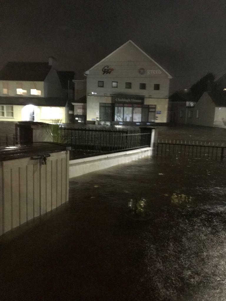
In the US, states like Florida, Louisiana, and South Carolina are seeing massive changes. Areas in Miami, FL, and Charleston, SC, are dealing with more than just hurricanes. They are facing "sunny day flooding" caused by rising tides. The Flood map 2026 shows that inland cities like Houston, TX, are also at risk because the ground just can't soak up the water fast enough.
2. United Kingdom: Riverine Flooding Trends
The UK is seeing a major shift in riverine flooding trends. Places like York, Shrewsbury, and parts of West Yorkshire are seeing rivers burst their banks more frequently. The Flood map 2026 indicates that even homes that have never flooded before in the Midlands are now in the "at-risk" category due to heavier winter rains.
3. Australia: From the Bush to the Coast
In Australia, the focus is on Lismore, Brisbane, and the Western Sydney floodplains. The Flood map 2026 reflects the harsh reality of the La Niña cycles that bring record-breaking rain. Additionally, residents in Gold Coast and Perth need to look at coastal erosion protection as the ocean inches closer to residential backyards.
What is Driving These Changes?
You might wonder why the maps change so much. There are three main reasons:
- Riverine Flooding Trends: Rivers are getting overwhelmed. When it rains heavily upstream, all that water has to go somewhere. If the riverbed is full of silt or the banks aren't high enough, it spills into your living room.
- Urbanization: We are building more roads and parking lots. Concrete doesn't soak up water like grass does. This creates "flash floods" in cities.
- Rising Sea Levels: For those on the coast, the "high tide" mark is moving up. This makes coastal erosion protection a top priority for local governments and homeowners alike.
The Importance of Early Warning Flood Systems
One of the best things you can do according to the Flood map 2026 report is to invest in technology. We aren't just talking about sandbags anymore. Early warning flood systems are now available for regular homeowners. These systems use sensors to tell you when water levels are rising nearby.
Having an early warning means you have time to act. You can move your car to higher ground, get your pets inside, and set up your flood barriers. In the world of water damage, five minutes of warning can save you thousands of dollars.
Coastal Erosion Protection: A New Challenge
If you live near the beach, the Flood map 2026 probably shows a shrinking coastline. This isn't just about big waves during a storm. It’s about the constant wearing away of the land. Coastal erosion protection involves building sea walls or using natural barriers like mangroves and dunes. However, as an individual homeowner, you also need to make sure your own foundation is protected from the rising water table.
How to Read Your Local Map
Don't let the technical terms scare you. When you open the Flood map 2026 for your town, look for these things:
- The Color Zones: Usually, Red or Dark Blue means high risk. Light Blue or Yellow means moderate risk.
- The Base Flood Elevation (BFE): This is a number that tells you how high the water is expected to rise. If your house floor is lower than this number, you have a problem.
- The Floodway: This is the path where water flows the fastest. You definitely don't want to be in the middle of this.
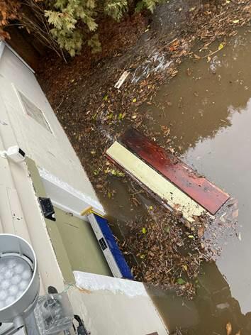
Why Sandbags Aren't Enough Anymore
For a long time, the "go-to" solution was sandbags. But let’s be honest: sandbags are heavy, messy, and they often leak. They also get contaminated by the dirty floodwater and have to be thrown away as hazardous waste.
Since the Flood map 2026 shows that floods are becoming a regular part of life, you need a solution that you can use over and over again. You need something that one person can install quickly without breaking their back.
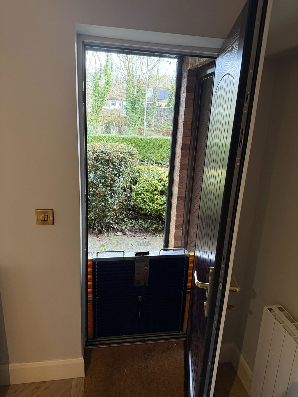
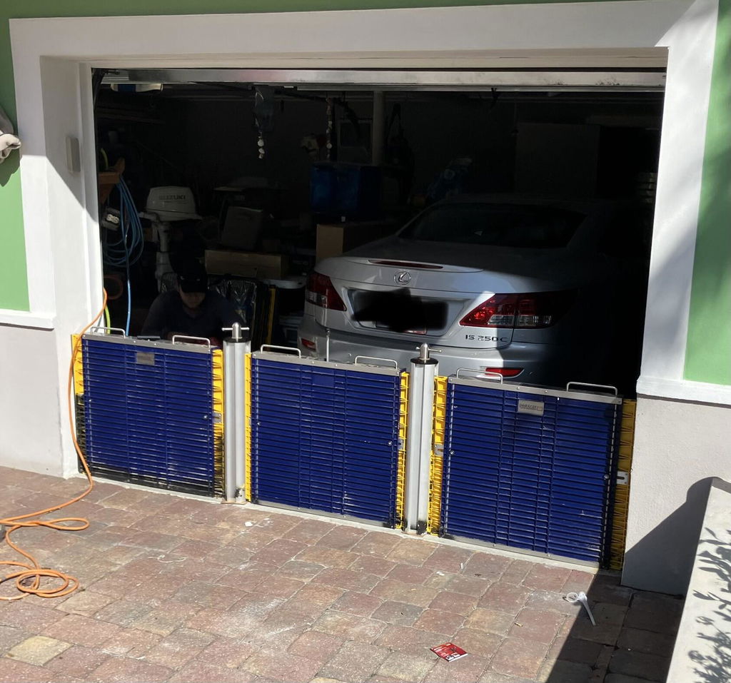
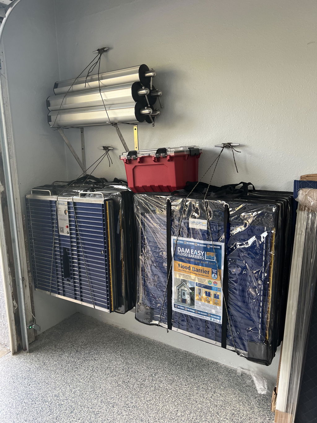
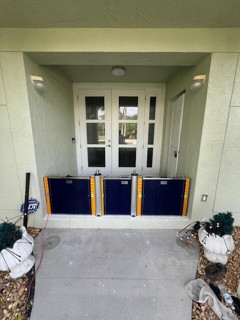
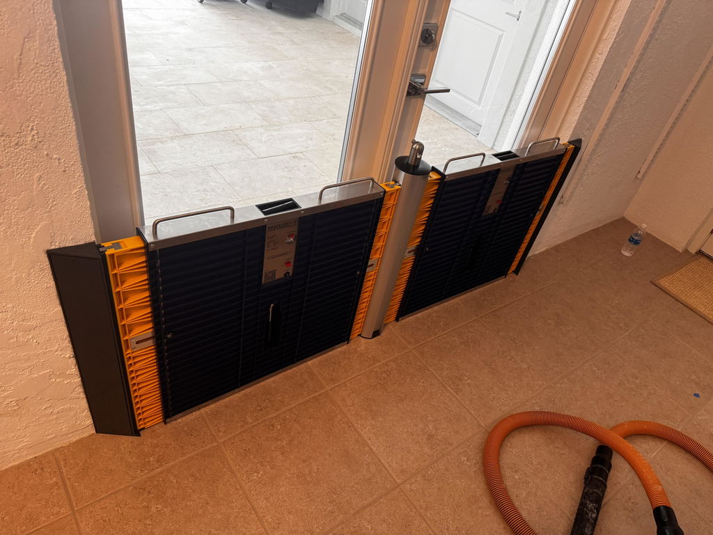
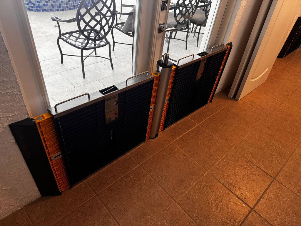
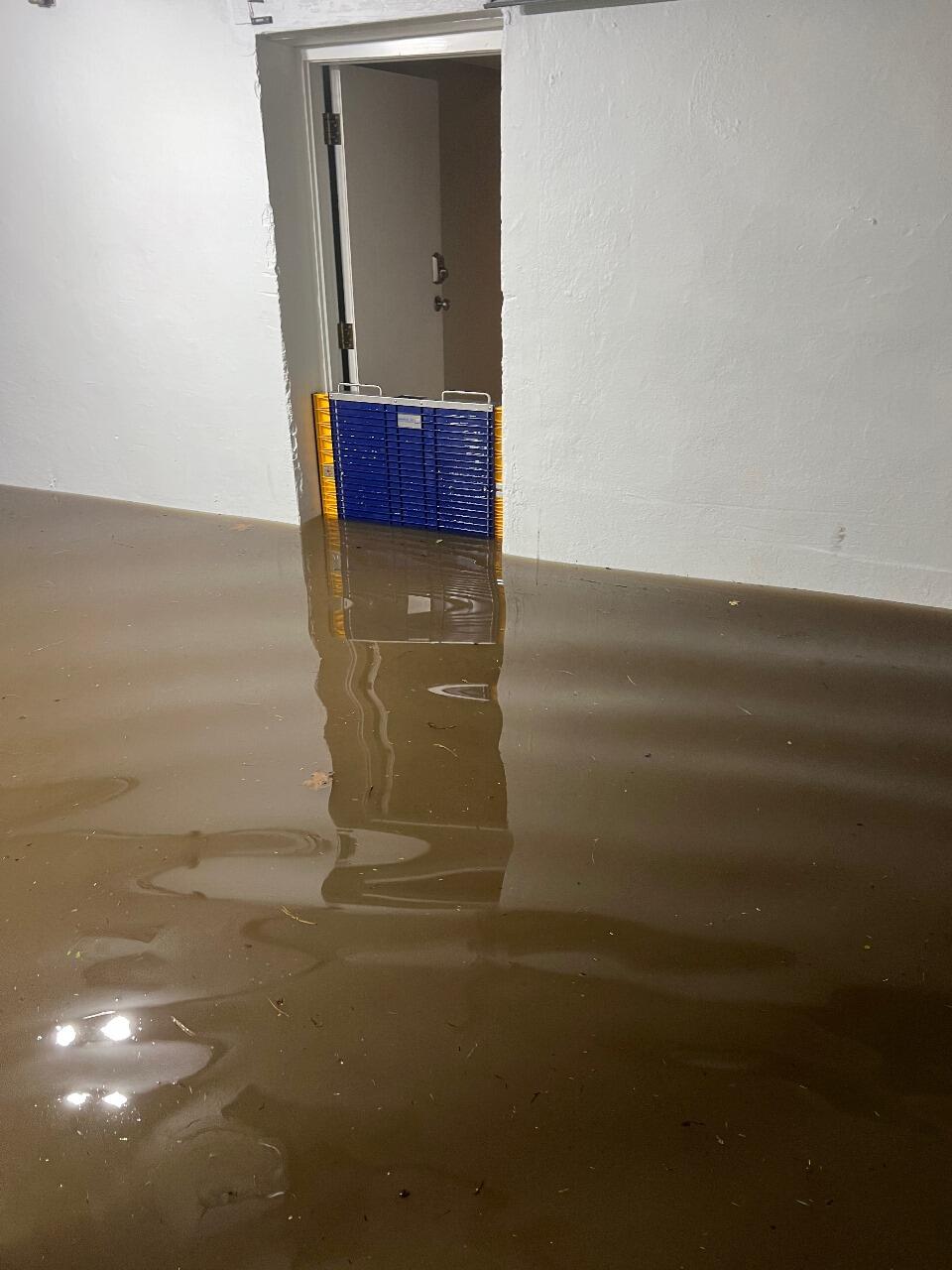
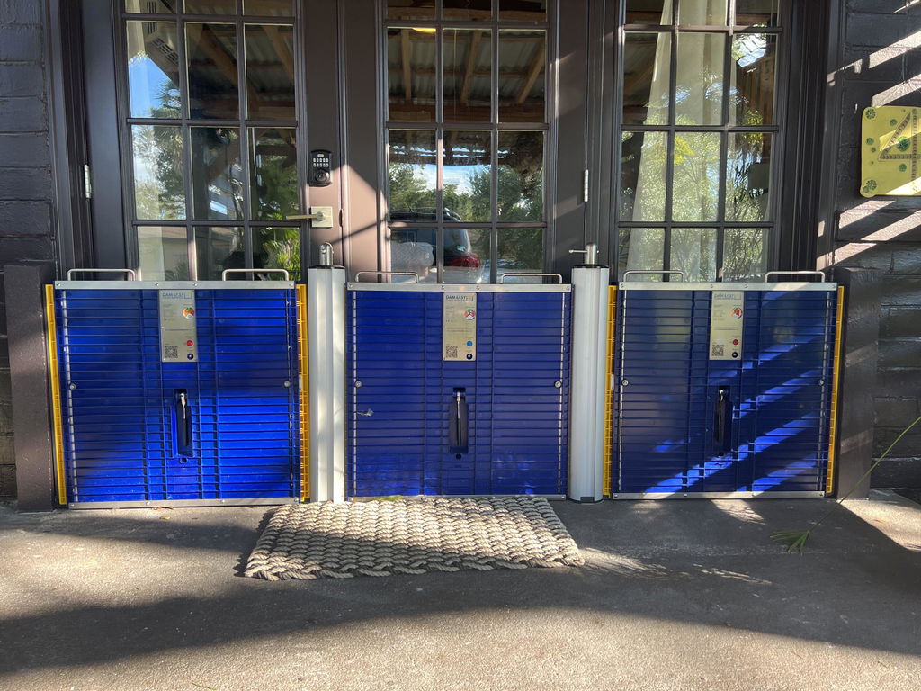
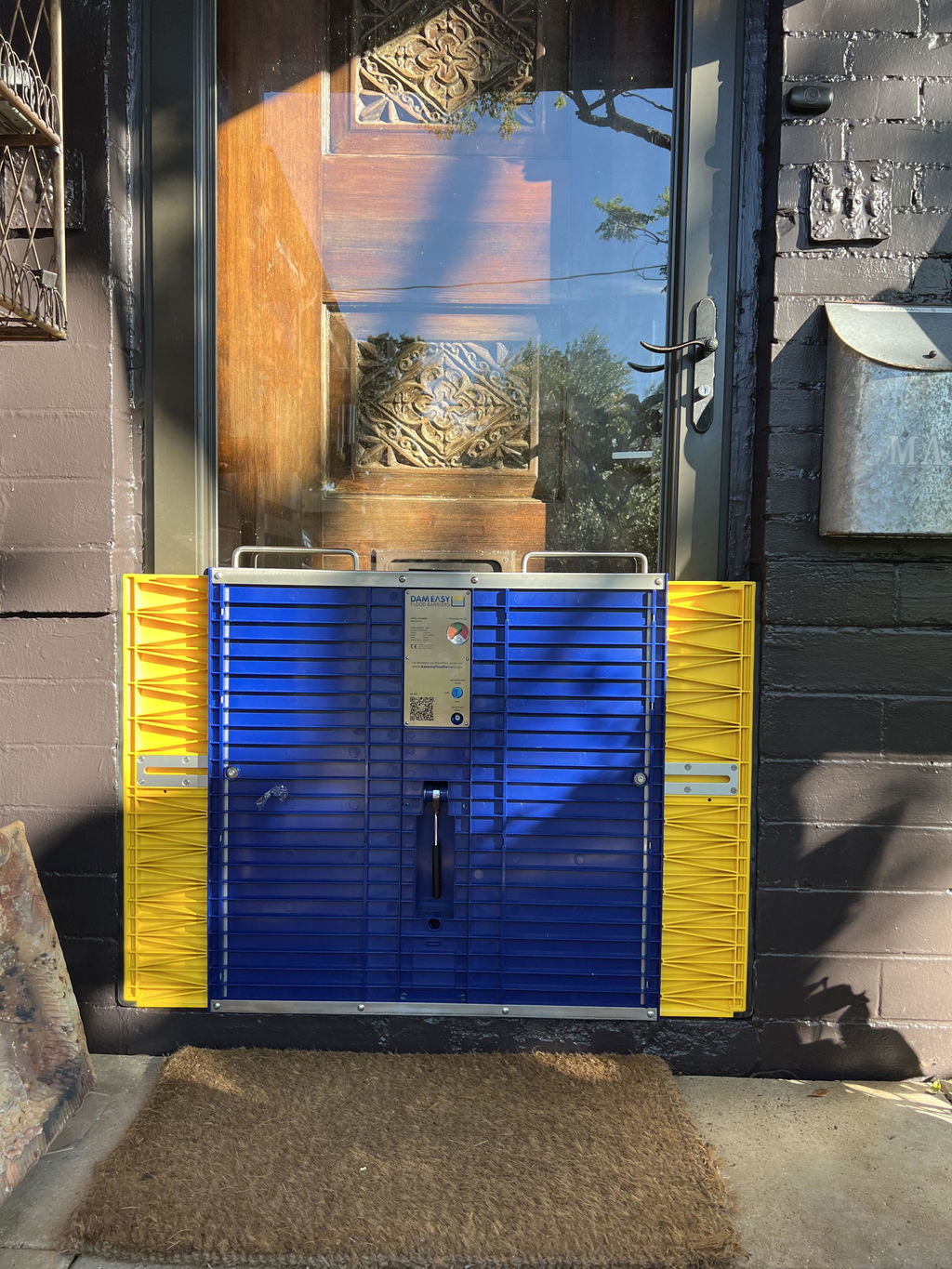
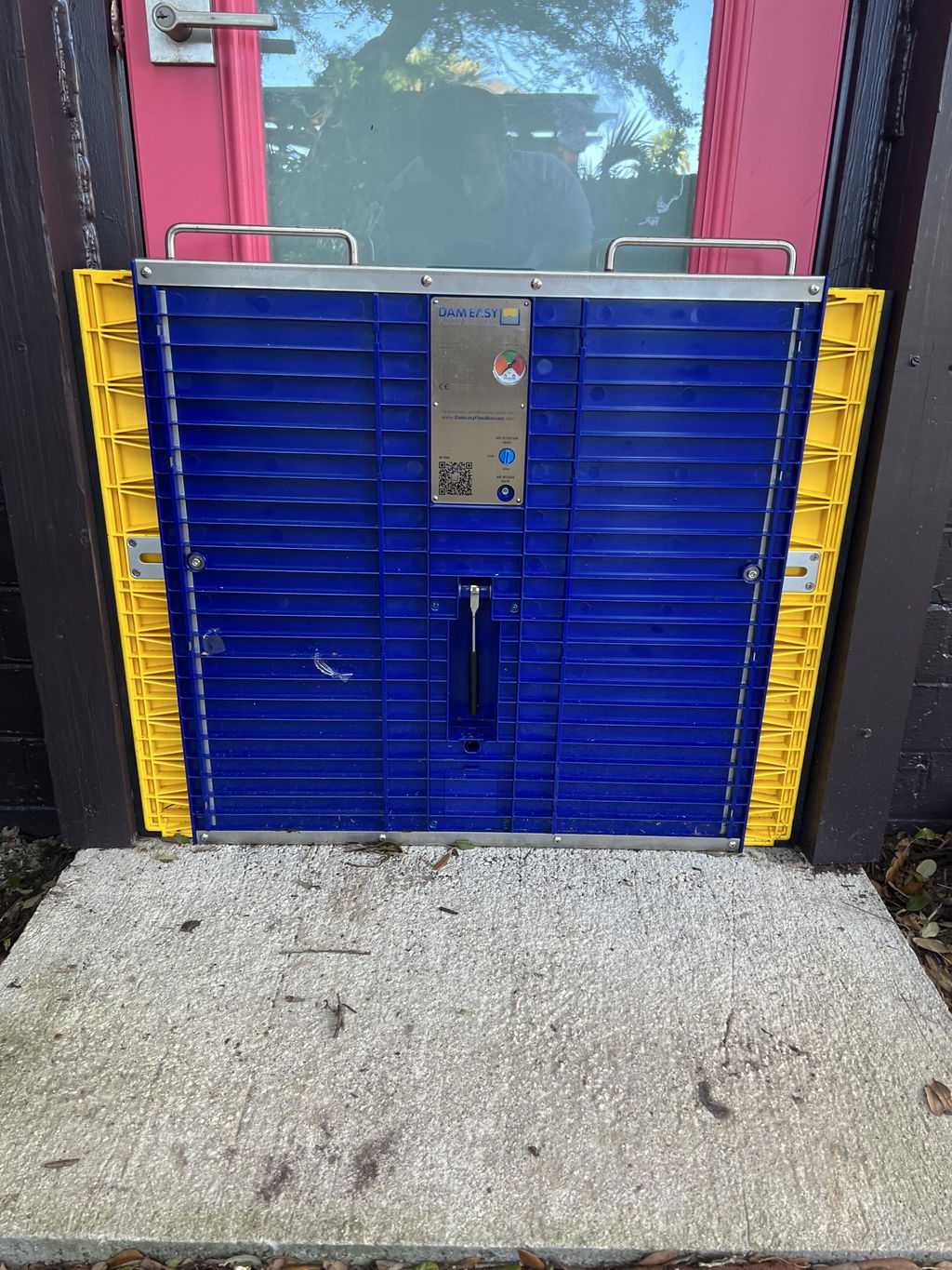
How Dam Easy Flood Barriers Can Help
At Dam Easy, we looked at the data from the Flood map 2026 and realized that homeowners need a professional-grade solution that is easy to use. Our flood barriers are designed to stay in your garage until you need them. When the clouds turn grey, you simply:
- Place the barrier in your door frame.
- Extend the sides to fit the width.
- Pump the built-in seal to create a watertight lock.
Ultimate Flood Barrier

$1,299.00
Floods are becoming more common around the world. What was once a 100-year phenomenon is now a seasonal trend that homeowners must deal with. That’s EXACTLY why you need this Dam Easy Ultimate Flood Barrier! An excellent alternative to heavy… Read More
It takes under five minutes. No tools, no permanent fixings, and no messy sand. Whether you are worried about riverine flooding trends in a UK village or a flash flood in a US suburb, these barriers provide the peace of mind you deserve.
Check Your Risk Today
The Flood map 2026 is a tool for preparation, not fear. By knowing your risk level today, you can make smart choices for tomorrow. Check your local government website to see the updated maps for your specific address.
If you find that your home is in a newly designated "Special Flood Hazard Area," don't wait for the first big rain of the season. Look into early warning flood systems and make sure you have your physical defenses ready.
Final Thoughts
Flooding is the most common and expensive natural disaster in the world. As the Flood map 2026 shows us, the zones are expanding. Protecting your home is about more than just saving your furniture; it's about protecting your family's peace of mind.
Visit our Dam Easy Product Collection to see how we can help you stay dry, no matter what the 2026 maps say. Stay safe, stay dry, and get prepared today.
FAQs
Where can I find the updated Flood map 2026 for my area?
You can find the Flood map 2026 data on official government portals such as the FEMA Flood Map Service Center (USA), the Environment Agency’s "Check Your Long Term Flood Risk" (UK), or local council websites (Australia). These maps are updated frequently to reflect new climate data and changes in land development.
Why has my property been moved to a high-risk zone in the 2026 maps?
Properties are often rezoned because of shifting riverine flooding trends and better satellite mapping. If your area has seen more heavy rain or new construction that prevents water from soaking into the ground, the Flood map 2026 will likely reflect an increased risk level compared to previous years.
Do I need flood insurance if the Flood map 2026 shows I am in a "Low Risk" area?
Yes, it is highly recommended. About one-third of all flood claims come from properties located in low-to-moderate risk zones. The Flood map 2026 identifies likelihood, but flash floods from poor drainage can happen anywhere. Additionally, insurance is often cheaper for those in low-risk areas, making it a smart preventative investment.
How do early warning flood systems work for homeowners?
Early warning flood systems use local sensors and real-time weather data to alert you when water levels near your property are rising. These systems send notifications to your smartphone, giving you the critical time needed to deploy flood barriers or move valuables before the water reaches your doorstep.
What is the best coastal erosion protection for residential homes?
The best coastal erosion protection involves a mix of local government infrastructure (like sea walls) and individual home defenses. For homeowners, ensuring your foundation is secure and having reusable flood barriers ready to block "sunny day" tidal flooding is the most effective way to prevent immediate property damage.
Can I dispute the findings of the Flood map 2026?
Yes. If you believe the Flood map 2026 incorrectly identifies your home as being in a high-risk zone, you can submit an application for a Letter of Map Change (LOMC). You will typically need to provide an elevation certificate or professional survey to prove your property sits higher than the projected flood levels.
How are riverine flooding trends changing in 2026?
Current riverine flooding trends show that "1-in-100-year" events are happening more frequently due to intense, short-burst rainfalls. This is causing rivers to rise faster than they used to, leaving less time for emergency services to respond and making personal home protection essential.